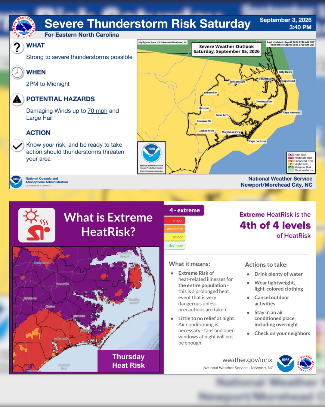
Here is the latest update on heat and severe weather impacts on Friday and Saturday, September 4-5, 2026.
All tagged severe weather
Here is the latest update on heat and severe weather impacts on Friday and Saturday, September 4-5, 2026.
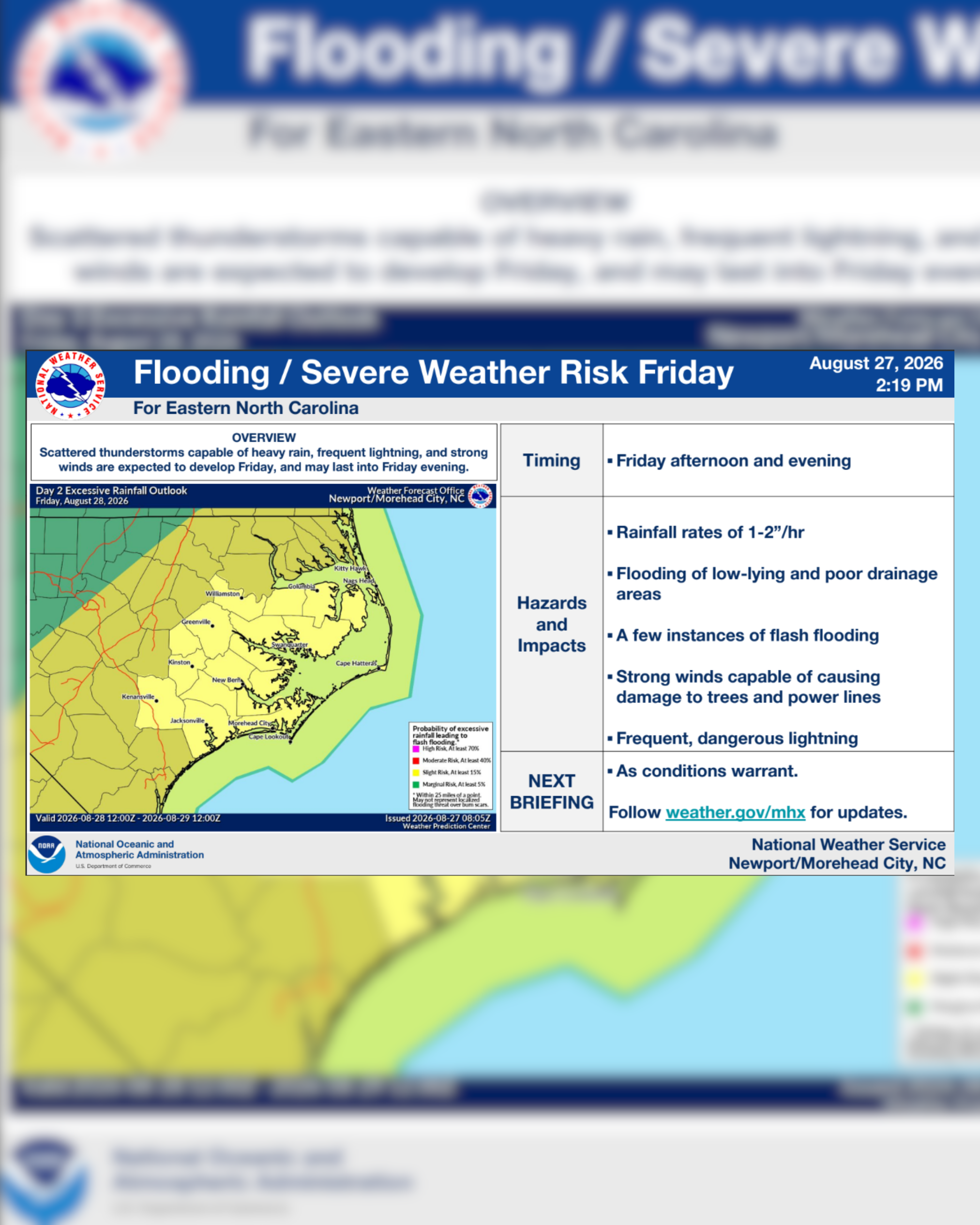
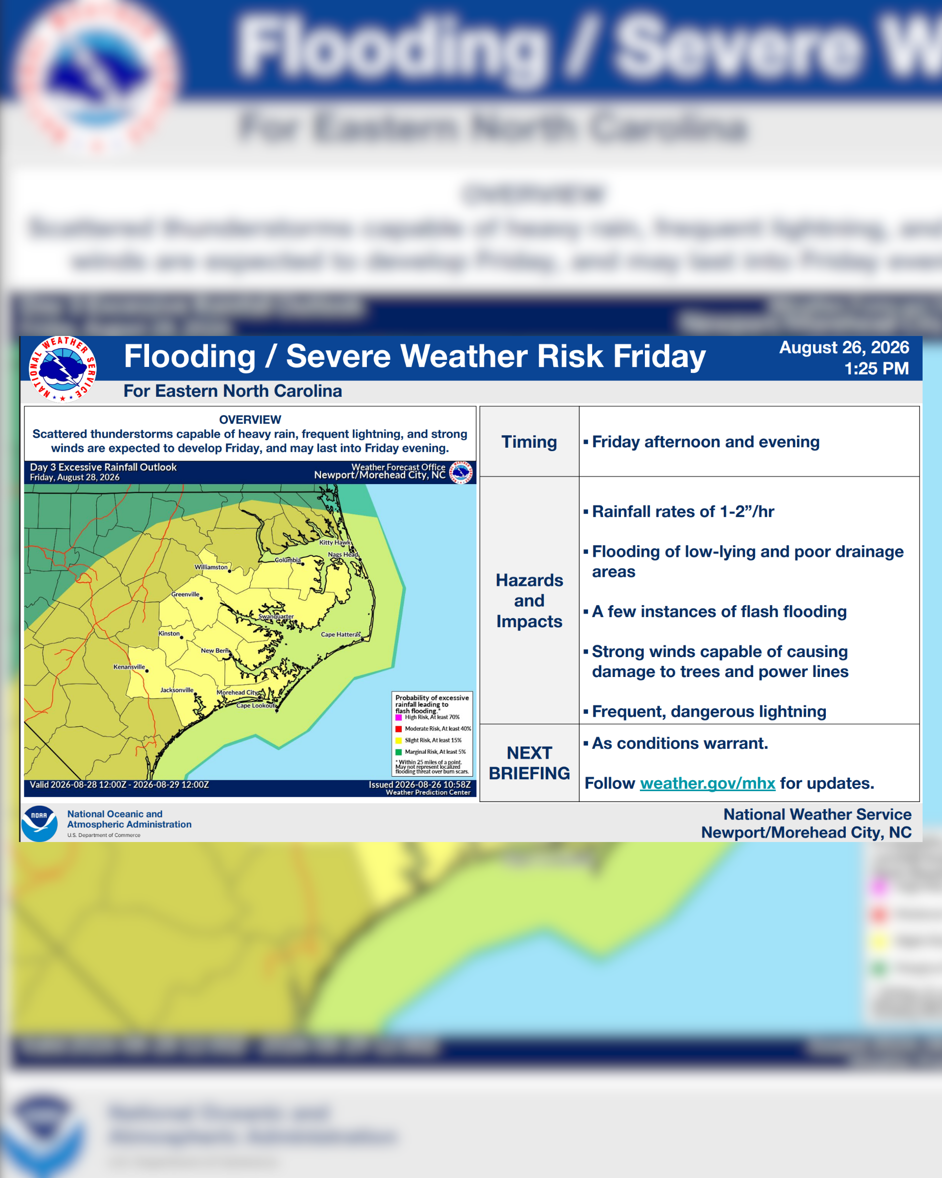
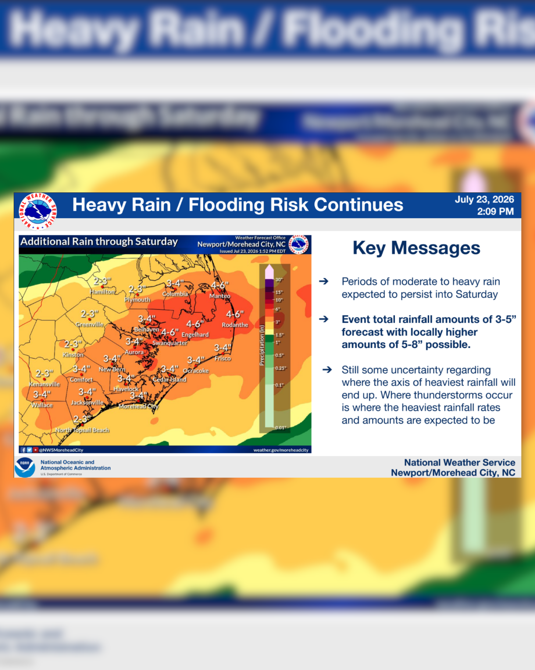
We continue to monitor the potential for heavy rain, flooding, and severe thunderstorms across parts of ENC on Friday, August 28, 2026.
NWS: We are monitoring the potential for heavy rain, flooding, and severe thunderstorms on Friday, August 28, 2026.
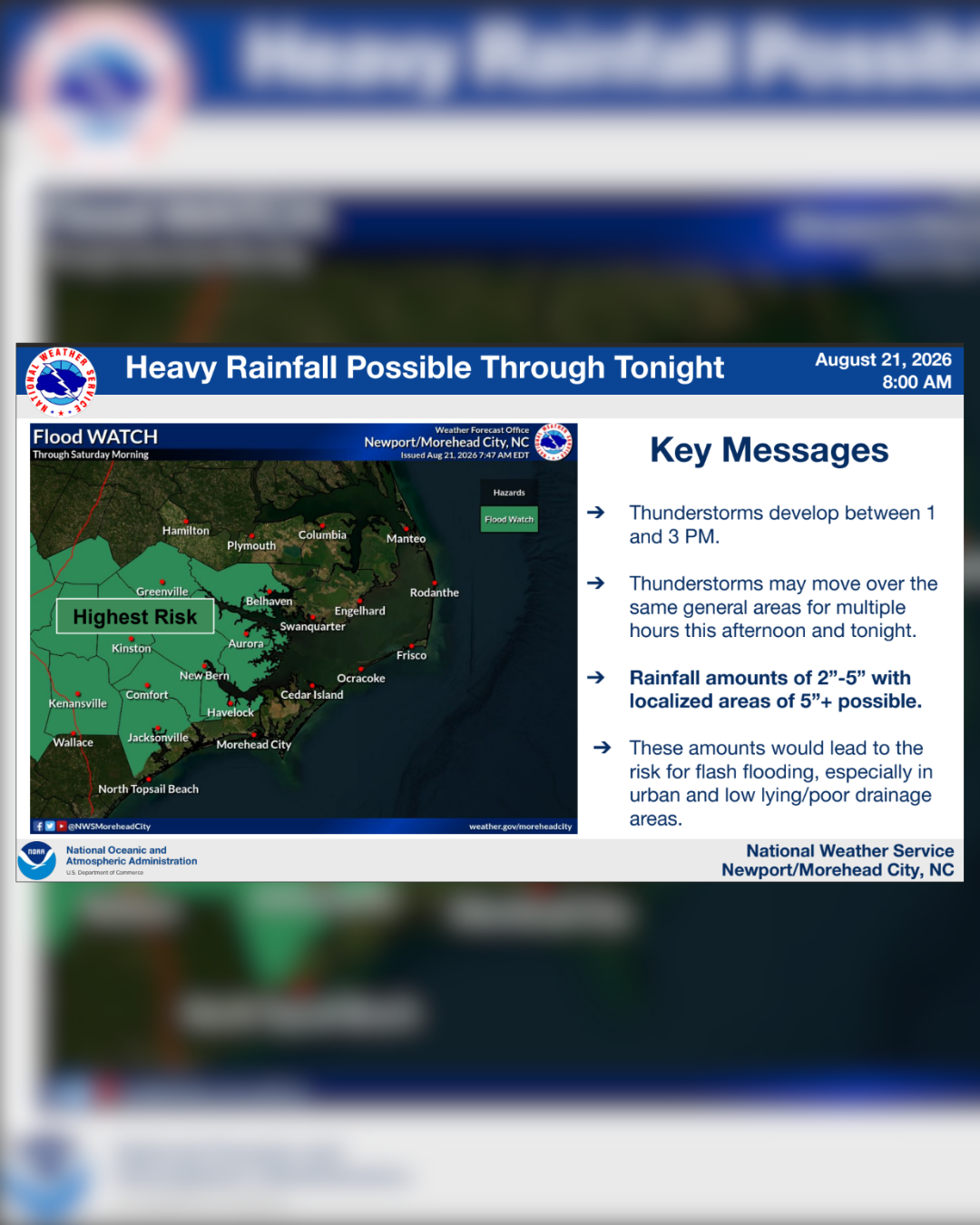
Please ensure you have multiple ways to receive warnings and communication even after you head to bed.
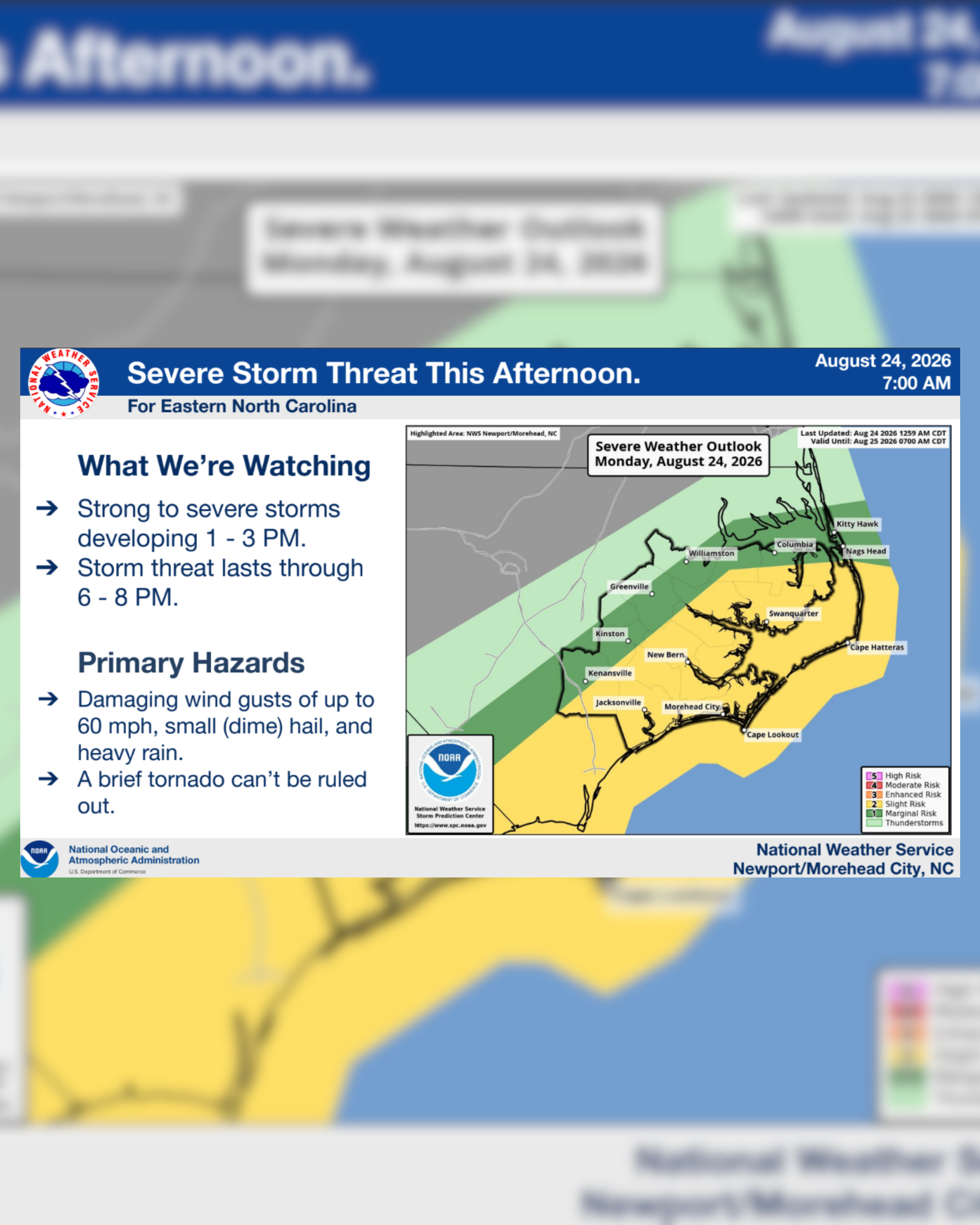
Strong to severe storms are also a threat, primarily this afternoon and evening, with the highest risk also from New Bern west. The main risks are damaging winds of 60+ MPH, but quarter sized hail and a tornado cannot be ruled out.
The flooding risk may continue into Saturday, especially across the southern half of ENC
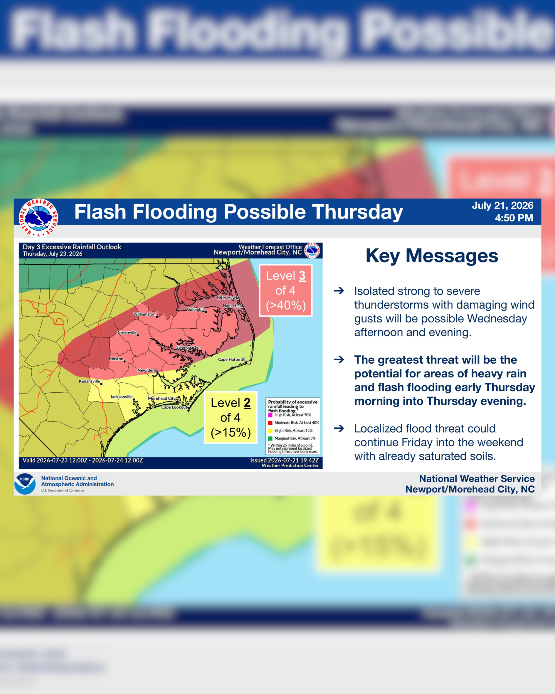
Isolated strong to severe thunderstorms with damaging wind gusts will be possible Wednesday afternoon and evening.
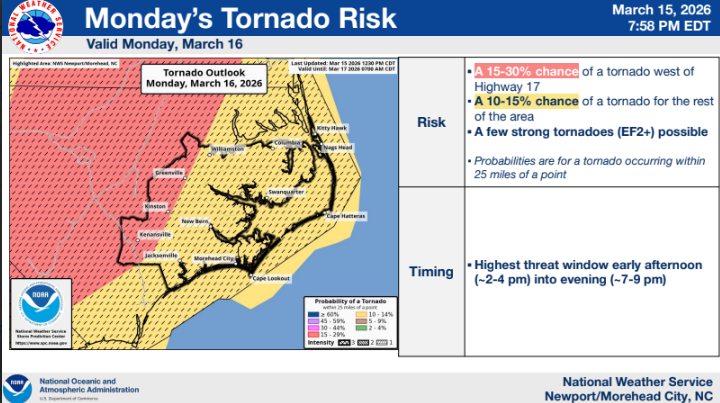
The threat for severe thunderstorms continues for Monday, March 16. This has the potential to be a significant severe weather event. In addition, there remains a marginal risk of severe thunderstorms this evening and overnight. Attached is the latest briefing for this event.
No major changes to the forecast this afternoon, but we have slightly increased snow totals across northern NC generally along and north of US 264, and we have slightly increased the area for the highest ice accretion across the coastal plain south of Greenville (and west of US 17).
A weak front moving into NC today will produce scattered to numerous showers and thunderstorms this afternoon and evening. The thunderstorms will have the potential to produce damaging winds, large hail, and torrential downpours.
There will be a slight risk (Level 2 of 5) of isolated to scattered severe thunderstorms developing across portions of eastern North Carolina today.
There will be daily chances for shower and thunderstorm activity today through Friday. A few of these storms have the potential to become severe with the greatest risk for severe weather being on Thursday.
NWS: Strong system has potential to produce severe weather Thursday, early Friday
Showers and a few embedded storms will overspread Eastern NC this morning. After a break in the widespread showers, additional scattered showers and thunderstorms may develop ahead of an approaching cold front from the west this afternoon.
A strong, complex low pressure system will impact eastern NC this weekend bringing the potential for heavy rain (Friday night and Saturday), isolated strong to severe thunderstorms (Saturday), strong winds, coastal flooding and dangerous marine conditions.
We are expecting strong to severe thunderstorms, strong winds, dangerous marine conditions, and minor coastal flooding for Eastern NC Friday evening into Saturday (January 12-13th.
A strong cold front that will impact eastern NC tomorrow and Wednesday.
Local news delivered to your inbox every day at 7am. Free, always.