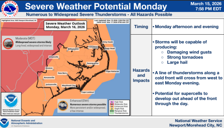
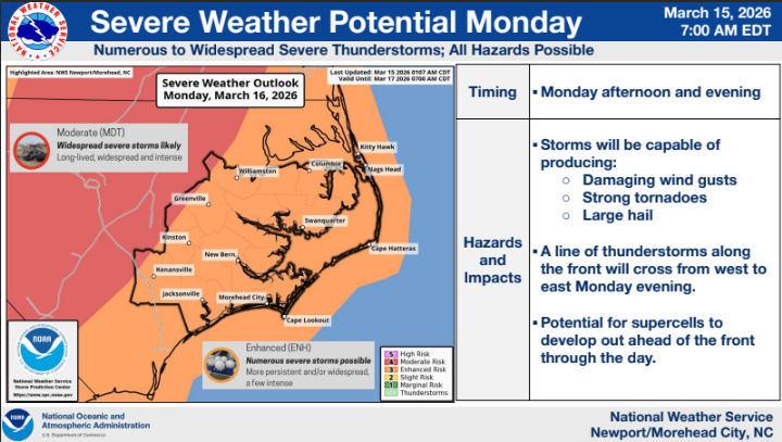
NWS: Severe weather for Monday significant
The threat for severe thunderstorms continues for Monday, March 16. This has the potential to be a significant severe weather event. In addition, there remains a marginal risk of severe thunderstorms this evening and overnight. Attached is the latest briefing for this event.
Key Messages
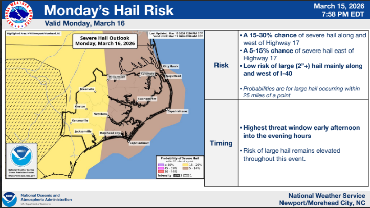
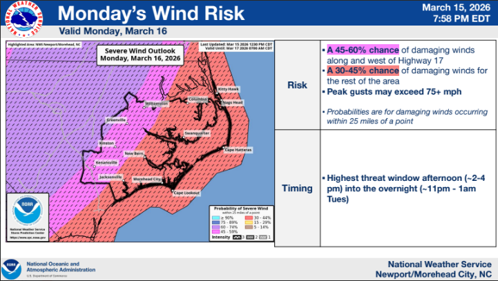
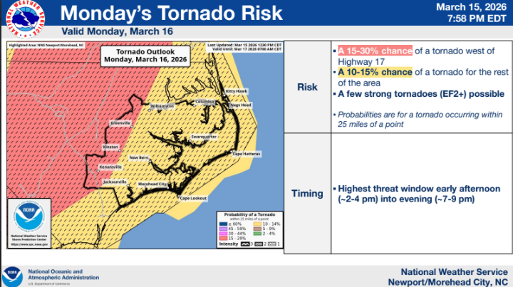
There is an Enhanced to Moderate (Level 3/4 of 5) risk of severe thunderstorms tomorrow, with the risk increasing to the west.
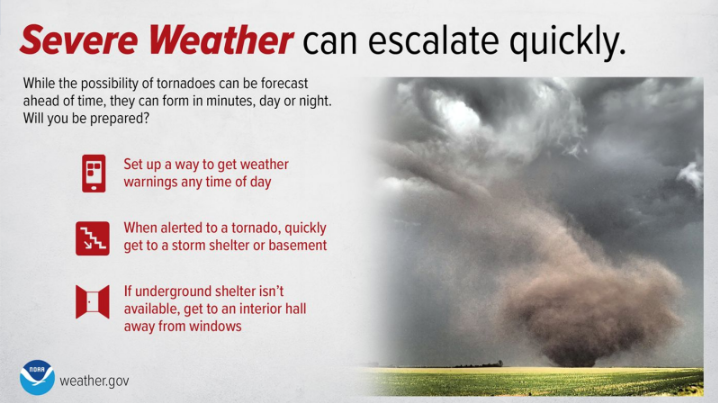
All hazards are expected tomorrow, but damaging winds and tornadoes will be the most prominent. Gusts in excess of 70+ mph, and a few strong tornadoes (EF2+) are possible.
Threat timing will be focused on Monday afternoon and evening. The tornado threat will be highest at the beginning of the event, with the wind risk peaking later in the day.
There is a Marginal (Level 1 of 5) risk of a few isolated severe thunderstorms through tonight with all hazards possible.