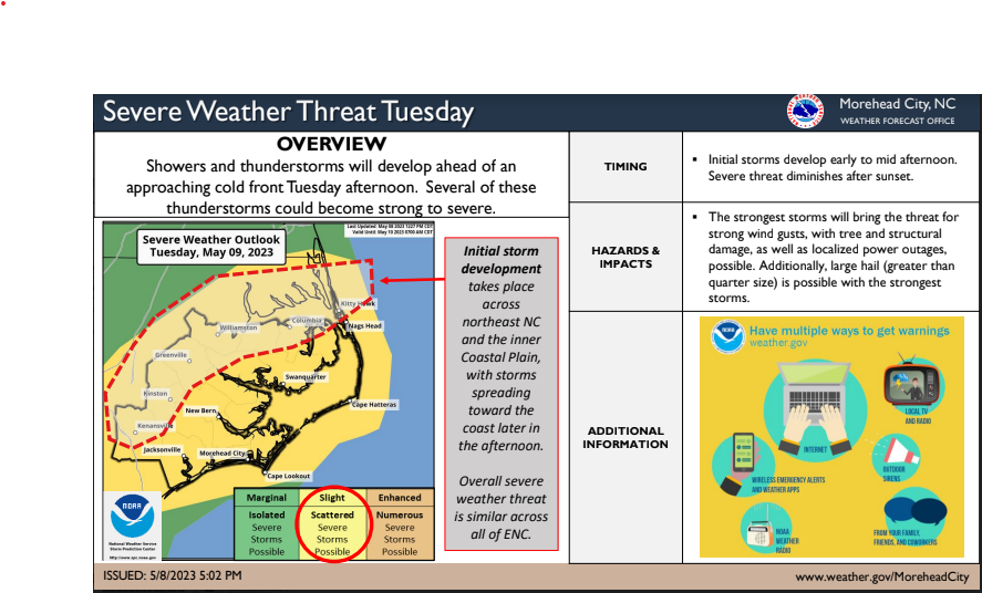
NWS: Severe Thunderstorm Risk Tuesday through Thursday
There will be daily chances for shower and thunderstorm activity from today through Thursday. A few these storms have the potential to become severe with the greatest risk for seeing severe weather occurring on Thursday.
- For todays severe weather risk, greatest threat would be mainly along the sea breeze. Storm coverage would be isolated and timing would mainly fall between about 2PM-8PM. The strongest storms would bring the potential for strong wind gusts and hail.
- For Wednesday, another isolated strong to severe thunderstorm risk will be possible with threat timing once again falling between the afternoon to early evening. A risk for strong wind gusts and hail would be the primary hazard within the strongest storms
- For Thursday the greatest risk for severe weather occurs out ahead of an approaching cold front with timing focused from the mid afternoon into the evening. Once again a risk for strong wind gusts and hail would be the primary hazard within the strongest storms