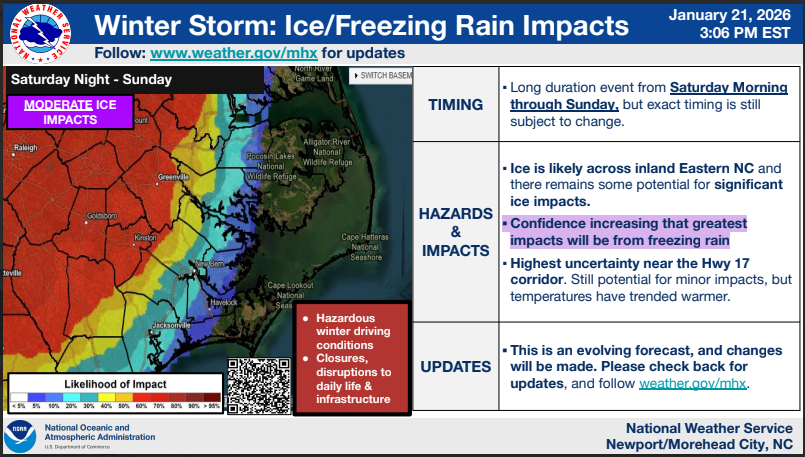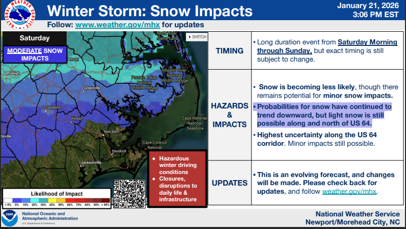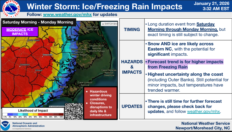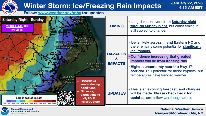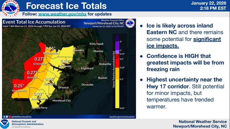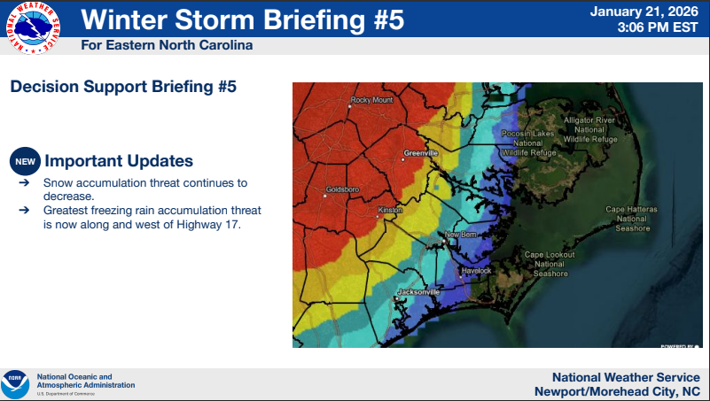
NWS: Snowfall probabilities continue to decrease, threat for ice and freezing rain impacts remain
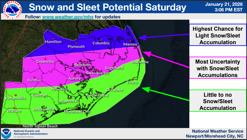
We have continued to see a warmer trend in the guidance over the last day or so. As a result, snowfall probabilities continue to decrease, though some light snow can't be ruled out primarily north of US 64.
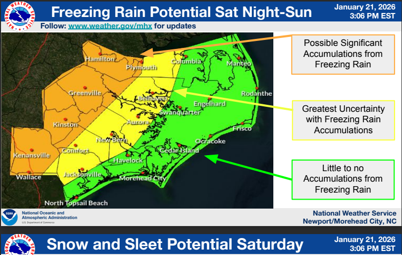
There remains a threat for ice and freezing rain impacts with the greatest threat being across the western Coastal Plain. Greatest uncertainty in freezing rain impacts has now shifted west to the Hwy 17 corridor with little to no freezing rain accumulation currently forecast along the coast.